Co-Directed by Derek Alderman and Josh Inwood

Google NotbebookLM Video on LBA: https://tiny.utk.edu/LBAshortvideo
Academia.edu Podcast Summary on LBA: https://tiny.utk.edu/LBApodcast
The Living Black Atlas creates a space within the discipline of geography and wider social sciences and humanities for curating, amplifying, and learning from the seldom-discussed cartographic practices undergirding the African American freedom struggle. More than a static collection of maps, the Atlas is infused with dynamic political understandings of the Black experience that challenge staid, flat, and Western notions of what a map is and how and where mapping takes place. In affirming the value of Black life and imagining more just futures, African American communities have long engaged in a tradition of counter-mapping, restorative cartographies, radical geospatial intelligence, visual storytelling, and embodied productions of geographic knowledge for the purposes of activism, community building and resilience, anti-racist navigation, and public pedagogy. The Living Black Atlas offers an enriched history of cartography that centers Black lives and geographies that have long been ignored in traditional GIS and geography circles. The Atlas can assist in creating the inclusive education necessary to broaden participation in the geospatial field and to do greater justice to the multiple spatial epistemologies (ways of knowing) and social power relations that circulate through and are realized through maps. Recognition of the Living Black Atlas is more than acknowledging diverse, alternative mapping traditions, but builds solidarity with diverse communities, making amends for past cartographic and social violence, and contributing to a reformation of the map itself as well as its ethical registers
Living Black Atlas-Related External Funding
$375,000. “Mapping Jim Crow from Below: The Student Non-Violent Coordinating Committee, Geospatial Intelligence, and Civil Rights.” National Science Foundation, Geography and Spatial Sciences. Co-PI with Joshua Inwood, 2017-2023 (Research Grant).

This funded project examined how Civil Rights Movement leaders and workers used geospatial data and techniques to calculate, map, and analyze the spatial and social dimensions of segregation and discrimination in the US South during the 1960s freedom struggle. To the left is a power map method innovated by SNCC’s Research Department to expose and track the social and spatial networks between institutions, corporations, governments, and places that supported white supremacy. At the center of this geospatial labor was the Student Non-Violent Coordinating Committee (SNCC), which engaged in counter-mapping and isurgent data collection, sharing, and analysis that informed civil rights projects but which have been largely neglected by social scientists. From their field-based operations in Deep Southern small towns and rural areas, SNCC workers strategically compiled, disseminated,understanding of the potential of geographical data collection, application, and analysis for and interpreted spatial and social information for the purposes of documenting and challenging white supremacy and racial inequality. Understanding how Civil Rights organizations engaged in this “Radical Geospatial Intelligence” advances an understanding of the potential of geographical data collection, application, and analysis to be utilized for the purposes of non-elite activism and social change. Completion of project, which resulted in a series of peer-reviewed articles in prominent journals and numerous conference presentations, inspired the researchers to examine the wider role of mapping–defined broadly and creatively–in Black freedom struggles and to link these moments of embodied cartographic activism, geographic knowledge production, informational praxis, and fugitive learning to a broader, still unfolding historical geography of Black place-making.
Living Black Atlas Media Engagement
-
MapLab: The Living Black Atlas (Bloomberg)
- Black communities are using mapping to document and restore a sense of place (The Conversation)
-
How Black cartographers put racism on the map of America (The Conversation)
Living Black Atlas-Related Publications
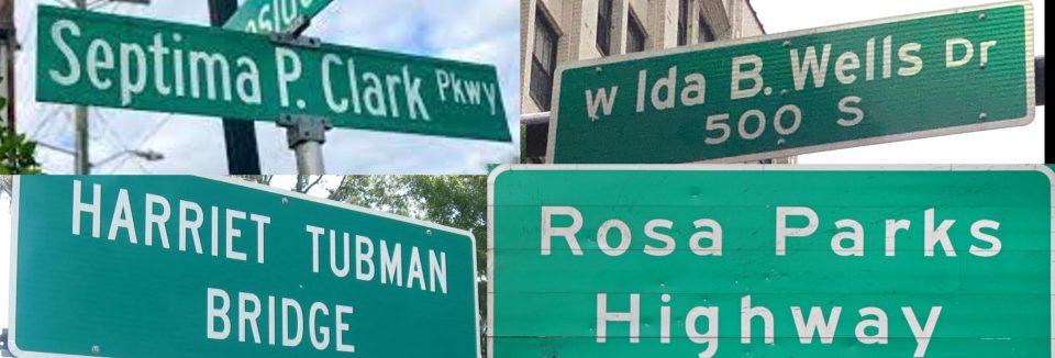
- Alderman, Derek H. and Joshua Inwood 2026. “Remapping the Legacy of Enslavement: Street Names, Stealth Stickers, and the Living Black Atlas.” Media and Communication 14: Article 10990.
- Podcast summary of article (Academia.edu)
- Alderman, Derek H., Mayra Román-Rivera, Michael Camponovo, and Reneé Kesler. 2024. “Mapping as Black Memory-Work: Toward a Restorative Cartography of Urban Renewal/Removal in Knoxville, Tennessee.” Geographical Review (for forthcoming special issue on community-engaged memory work).
- Podcast summary of article (Academia.edu)
- Alderman, Derek H. and Joshua Inwood. 2024. “On The Living Black Atlas: Learning Geospatial Ethics from the African American Freedom Struggle.” The Cartographic Journal (forthcoming for special issue “Geospatial Ethics: New Directions.”)
- Podcast summary of article (Academia.edu)
-
Alderman, Derek H., Joshua Inwood, and Katrina Stack*. 2024. “Taking a Longer Historical View of America’s Renaming Moment: The Role of Black Onomastic Activism within the Student Nonviolent Coordinating Committee (SNCC).” Humanities & Social Sciences Communications 11(704): 1-11. https://doi.org/10.1057/s41599-024-03182-3
- Podcast of summary of article (Academia.edu)
-
Alderman, Derek H., Bethany Craig*, Joshua Inwood, and Shaundra Cunningham.* 2023. “The 1964 Freedom Schools as Neglected Chapter in Geography Education.” Journal of Geography in Higher Education 47 (3): 411-431.
- Podcast summary of article (Academia.edu)
- Inwood, Joshua and Derek H. Alderman. 2022. “Performing the Spadework of Civil Rights: SNCC’s Free Southern Theater as Radical Place-Making and Epistemic Justice.” GeoJournal 87(5): 3719-3734.
- Alderman, Derek H., Joshua Inwood, and Ethan Bottone*. 2021. “The Mapping Behind the Movement: Recovering the Critical Cartographies of the African American Freedom Struggle.” Geoforum 120: 67-78.
- Podcast summary of article (Academia.edu)
- Yessler, Reagan* and Derek H. Alderman. 2021. “Art as “Talking Back”: Louise Jefferson’s Life and Legacy of Counter-Mapping.” Cartographica 56(2): 137–150.
- Inwood, Joshua and Derek H. Alderman. 2020. “’The Care and Feeding of Power Structures:’ Re-conceptualizing Geospatial-Intelligence Through the Counter-Mapping Efforts of the Student Non-Violent Coordinating Committee.” Annals of the American Association of Geographers 110 (3): 705-723.
- Inwood, Joshua and Derek H. Alderman. 2018. “When the Archive Sings to You: SNCC and the Atmospheric Politics of Race.” Cultural Geographies 25(2): 361–368.
- Alderman, Derek H. and Joshua Inwood. 2016. “Civil Rights as Geospatial Work: Rethinking African American Resistance.” Race, Ethnicity, and Place in a Changing America, Third Edition. SUNY Press (edited by John Frazier, Eugene Tettey-Fio, and Norah Henry), pp. 177-185.

Lynchings by the state in the United States were compiled and published by the NAACP in the early 20th Century as part of civil rights organization’s program of using mapping to protest against white mob violence and push for federal legislation to protect Black Americans.
